Warrensburg Historical Highlights Tour
Curated by University of Central Missouri History Program UCM Public History Students, Graduate Students Paxton Stover and Paul Atwood under the guidance of Dr. Jon Taylor, UCM History Department
This Warrensburg Historical Highlights tour features some of the prominent historic sites in Warrensburg, Missouri.
https://historicmissouri.org/tours/show/1
Welcome to a Driving Tour of Sites of Historic Places in Warrensburg and Johnson County Missouri, developed by Bill & Sandra Wayne
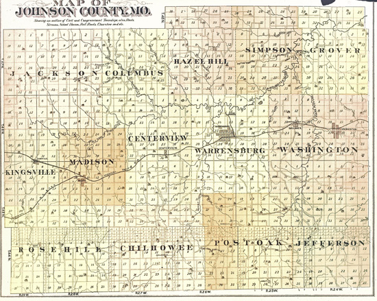
You may also view the tour stops on a map
Start the tour at the Warrensburg Depot (Holden Street at the Railroad Tracks)
Go south on Holden 1 block, left on Grover Street 1 block. The 200 block of Grover is
Stop 1, Grover Street Victorian Historic District. 9 houses, most from Victorian era.
Return to Holden Street, go south 1/2 block, right on Ming Street 2 blocks, right on Warren Street 1 block.
Stop 2, 1899 Warren Street M.E. Church, Warren & Madison Streets. Church is now closed, believed to be under internal restoration. (Architecture, Ethnic Heritage: Black)
Turn Right on Madison Street 1 block to Washington Street. Left on Washington Street to Pine Street. On the SW corner of Washington & Pine is the former site of Magnolia Mill, a wooden mill/elevator torn down in the early 2000s. Turn right on West Pine
Stop 3, Holden and Pine Streets Commercial Historic District. This district includes most of downtown Warrensburg on Holden & Pine streets.
Left on Holden 1/2 bock to E. Pine Street, Right on East Pine one block to College Street
Stop 3A, Jones Brothers Mule Barn. 1912 mule barn and major shipping point for Missouri mules. Subsequently served as a hardware store for many years.
Turn right on College 1 block to Railroad. Right on Railroad to Holden, right on Holden Street
Stop 3 Continuation – Holden and Pine Streets Commercial Historic District, for 2 more blocks.
Corner of Holden & Market Streets
Stop 3B, 1898 Johnson County Courthouse. The Courthouse is open daily for public business, with historic information available at the County Clerk’s office, (660)747-6161. (Architecture, Politics/Government)
Stop 3C, 1894 Masonic Temple. Immediately east of the Courthouse across Holden Street, now restored and occupied by shops and offices. Not open for tours. (Social History)
Continue north on Holden Street across US-50 overpass about 2 miles. On your right, you’ll see
Stop 64, 1928 Garden of Eden (Ben Pickel) Gas Station, old Missouri 13 North. Early gas station rendered in local sandstone. Only a drive-by observation of site – no tour. (Architecture, Commerce)
Return south on Holden Street to Gay St. (2nd 4 way stop). Turn right (east); 2 blocks on your left at the south corners of Warren & Gay are
Stop 5 1888 Herbert A. & Bettie E. Cress House, 222 W. Gay (SE corner). Only a drive-by observation of site – no tour. (Architecture)
Stop 5a, Lewis and Sophie Griebel House, 300 W. Gay (SW corner) an 1885 Folk Victorian house. Only a drive-by observation of site – no tour. (Architecture)
Turn left on Warren Street two blocks to Culton Street. Turn right on Culton Street 1 block past the
Site of Howard School. This was the the second oldest remaining black school established under the Freedman’s Bureau after the Civil War. The 1880s building, collapsed and was removed around 2016.
Continue west on Culton Street to top of hill. Turn right on Main St. On your left, you’ll see
Stop 6, 1842-1878 Old Johnson County Courthouse (restored to ca.1870 appearance). Tours available by contacting Mary Miller Smiser Heritage Library & Museum, 304 N. Main St., (660)747-6480. The Old Courthouse is part of the Johnson County Historical Society’s museum complex & was the site of the famous Old Drum trial in 1870 and a political gunfight in 1861. Hours: Tues. – Fri. 1-4 PM; $3 admission. (Architecture, Political)
Continue north to Young St. (Business 50). Turn left on Young St. to U.S. 50. Go west 5 miles on U.S. 50 to MO 58. Follow MO 58 14 miles to Holden. Turn North on MO 131 about 1/4 mile to:
Stop 7, Joseph M. Miller Mausoleum. Hand-built family mausoleum is undergoing renovation. Exterior pictures only.
Return to Holden and continue south on MO-131 about 4 miles to
Stop 7A, 1915-1949 Pleasant View School, 674 SW MO Hwy 131 (Medford area). Illustrates architectural & educational design of a well-preserved country school.
Continue south on MO-131 about 4 miles to MO-2. East on MO-2 10 miles to Chilhowee. Turn right on Main Street to:
Stop 8, 1904-1930 Chilhowee Historic District. This is the old Chilhowee business district, about 1 block long at Walnut & Main Streets. A number of buildings have been lost in recent years to fire or collapse (Architecture, Commerce, Agriculture)
Return to MO-2 and turn east (right) to MO-13. Turn left (north) on MO-13 about 8 miles to Rt. Y. Turn right (east) on Y 4.0 miles to
Stop 9, 1867-1895 John A. Adams Farmstead Historic District, 431 SE County Road Y. Tours available by appointment only; call (660)624-4944. (Architecture, Agriculture – Drainage System & Architecture)
Continue east on Rt. Y 6.3 miles to MO-23. Turn left (north) 5 miles on MO-23, which passes by the west side of Whiteman Air Force Base (watch for the Stealth bomber flying by!) to Rt. DD. Turn left (west) on DD for about 1/4 mi to a park entrance road. Turn right on the entrance road and follow it to the Visitor Center at
Stop 10, Knob Noster State Park, the Montserrat Recreation Demonstration Area, with 5 sites & one historic district depicting Depression era CCC & WPA architecture in Missouri State Parks. These include: Sites – Bridge, Dam Spillway, Entrance Portal, Rock Bathhouse, Warehouse #2 Workshop. Historic District – Camp Shawnee. Phone Visitor’s Center for Park information and map: (660)563-2463. (Depression Era Architecture)
Return to Rt. DD, head west to Warrensburg. Thanks for sharing our Johnson County History.

You must be logged in to post a comment.